")
")
")
")
DESCRIPTION
 The Vistula Lagoon is a basin of marine internal waters. From the south, limited by the Elbląg Upland from the north by the Vistula Spit. The eastern part is the water border with the Russian Federation. Abroad the waters of the Kaliningrad Lagoon and the Piławska Strait, allowing for going out to the Baltic Sea.
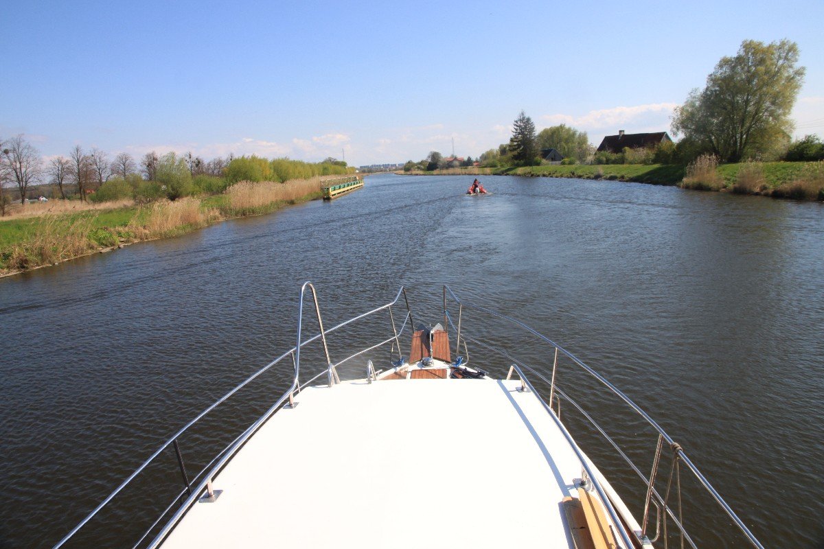
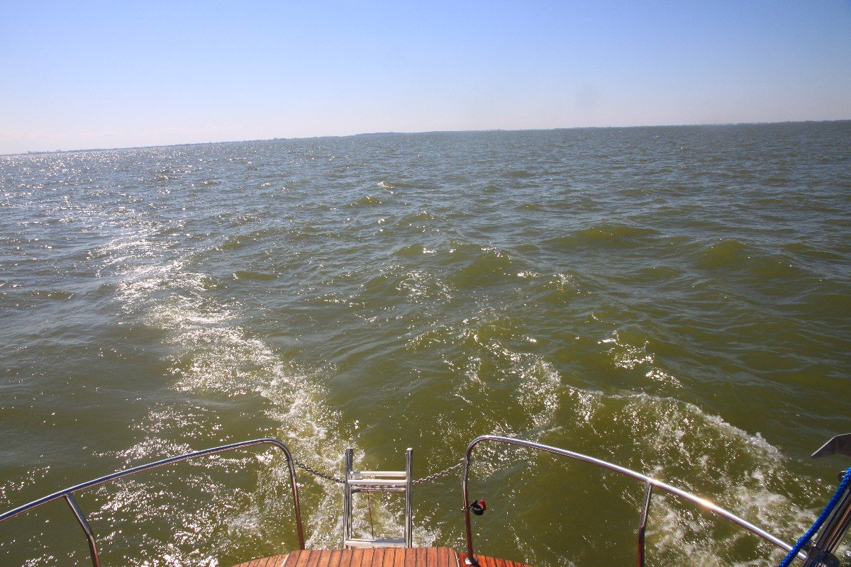
The "Maritime" of the Lagoon caused his long-term blockade for sailors. The landlords once did not have access, and for sailors who had yachts after dealing with "papermaking" on the Lagoon it was too crowded when they had the Gulf of Gdansk and the Baltic. The small depth of the Lagoon was also a big problem, as well as continuous shallow water ports and tracks. Freely sailing here is a yacht with a draft not exceeding one meter. In turn, these small depths with rapid weather change cause the formation of a short, steep wave that can disturb even sailors. In 2009-2014, on the Vistula Lagoon, there were "revolutionary" changes. With the support of the European Union, infrastructure in ports and marinas was built or modernized. Investors were local governments as well as private investors.
PILOTAGE
The area of the Lagoon is 382 km2 (including the Kaliningrad Zalew 838 km2), the length is 35.1 km (together with the Kaliningrad Lagoon 90.7 km). The width of the Lagoon varies from 6.8 km to 13 km, with an average depth of 2.7 m. The further east, the deeper.
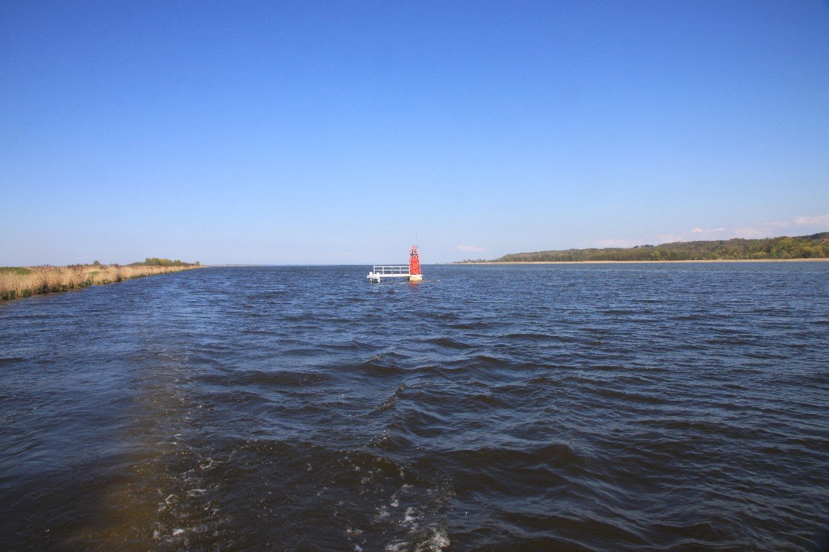
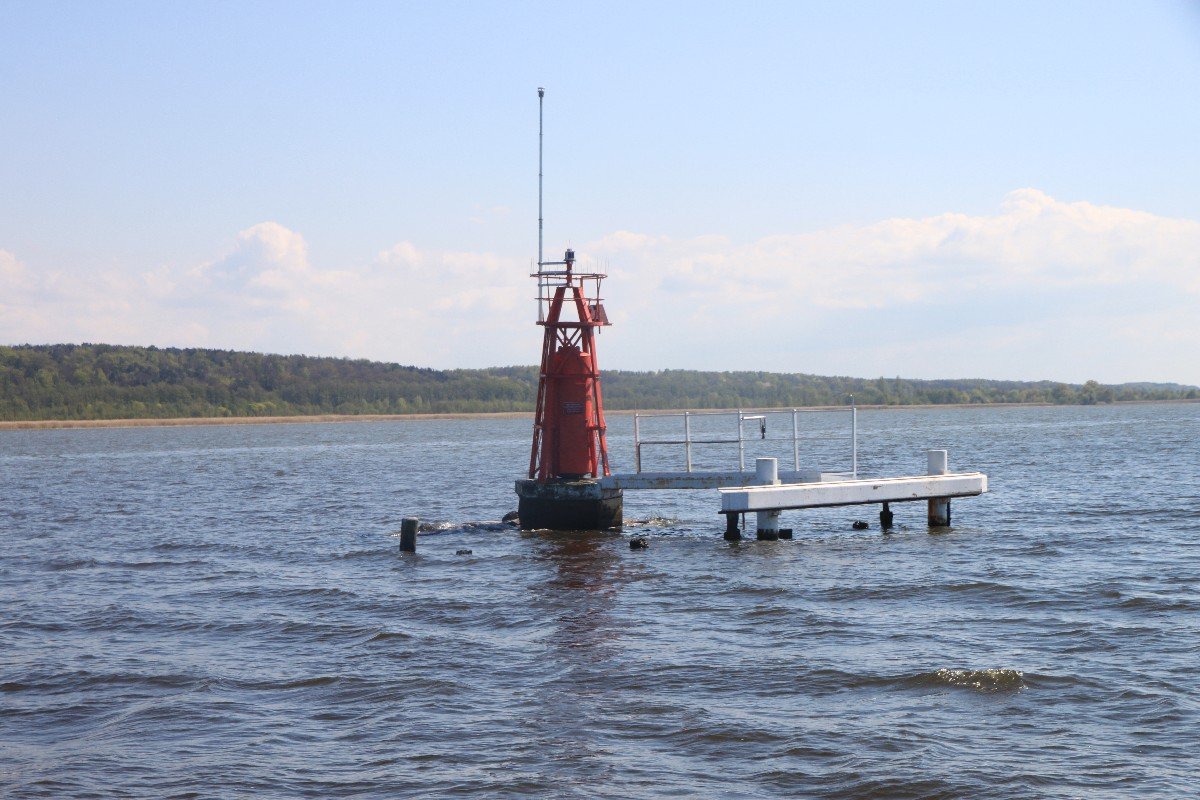
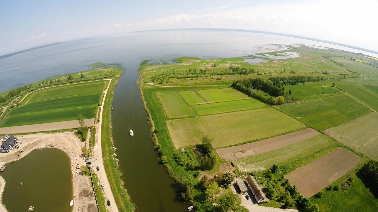
The main fairway of the Lagoon is in the shape of the letter "Y", directed with the foot towards the east. The northern arm is the approach to the Szkarpawa, and the southern arm is the approach to the Elbląg River. The fairway runs as follows: North arm: the outlet of the Szkarpawa - Gdańsk pond - the Elbląg pond. Important points of the road: light buoy no. 18 (outlet of the Szkarpawa), Gdańsk pond and further unlearning buoys, up to the Elbląg ponds. Southern arm: Elbląg river - Elbląg light (called "Andzia") - Elbląg pond (called "Piotrus"). Important points of the road: Lewa Główka Wejściowa (LGW) on the Elbląg River (red navigation light), Elbląg light (called "Andzia", which is PGW - the Right Head of the Entrance to the Elbląg River, located on the Golden Island). PGW and LGW are asymmetrical. The light of Elbląg and the pond of Elbląg are often confused with each other. "Andzia" creates the first track gate with the light buil number 10 ELB. The next gate is composed of non-luminous buoys. The next shining ones are the 1 ELB (green) and 6 ELB (red) buoys. Further, up to the ponds of Elbląg, there are non-luminous buoys. Both arms of the fairway merge at the Elbląg pond, from where the fairway continues to the east, up to the state border separating the Vistula Lagoon from the Kaliningrad Lagoon. Main fairway: Elbląg pond - buoy TOL - buoy FRO - Polish-Russian border. Important points of the road: Elbląg stela (luminescent, of course), then the next TOL light buoy, light buoy no. 4, non-luminous PIA buoy, light buoy no. 1, non-luminous PAS buoy and light buoy no. 10.
Approach tracks to the ports. From the main track to individual ports lead approach tracks marked with buoys, and in front of the ports themselves mostly gates. These are approach tracks to Piasków, Nowa Pasłęka, Frombork, Krynica Morska, Tolkmicka and Kątów Rybackie.
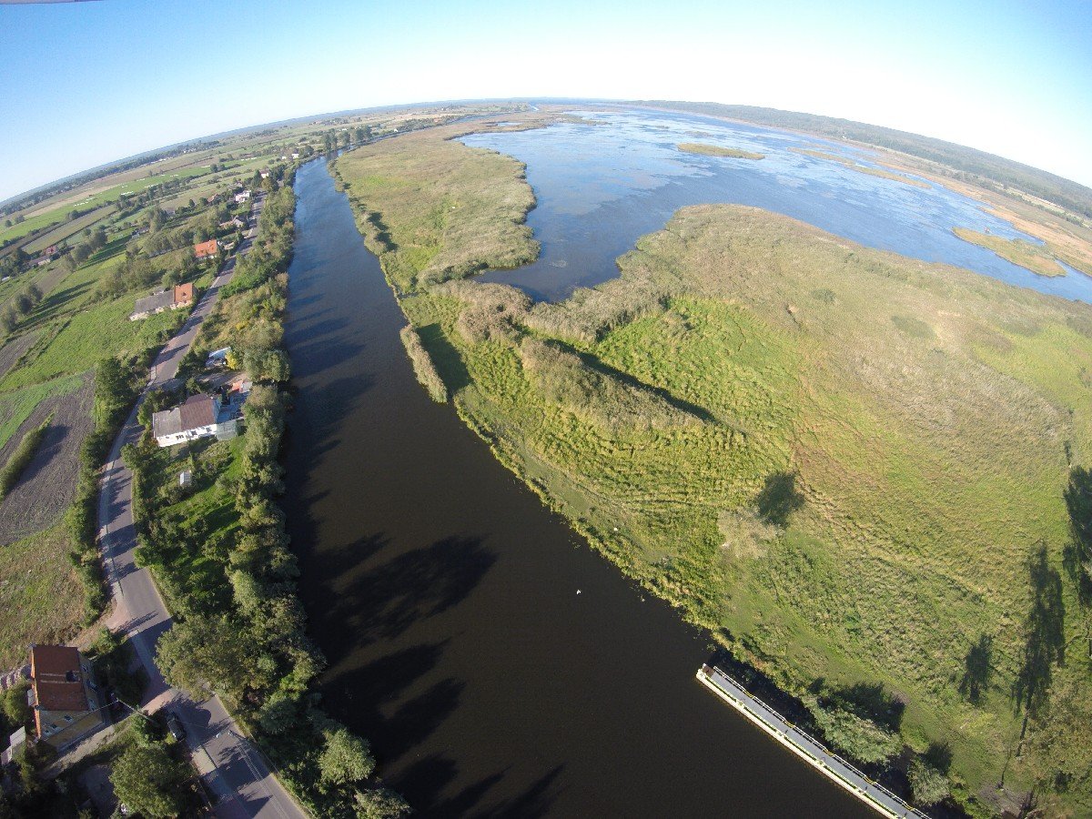
Elbląg Bay is the southern part of the Vistula Lagoon, more reminiscent of Masurian Lakes or Jeziorak. The shield of the Nowakowska Island means that the wind and wave are smaller here than on the open waters of the Lagoon. The bay is a very shallow reservoir. The average depth is 1-1.5 m, and the farther south, the shallower. The exception is the water reservoir of the Zalew - Elbląg. On the Elbląg Bay stretch, the guaranteed track depth is 2.20 m, further on the Elbląg 3.5-4 m. Ports on the Bay are small with poorly developed water sports infrastructure. The largest port in the region is Suchacz, available for yachts with a draft of up to 1.5 m. The remaining ones are available for yachts with a smaller draft - Nadbrzeże (1.2 m), Kamienica Elbląska (1.2 m), Jagodna (0.80 m) .
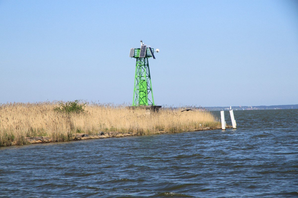
Navigate marks of the Vistula Lagoon. The Vistula Lagoon belongs to the internal sea waters and is marked according to the IALA system of Region A, as well as at sea. Thanks to this, sailors have the opportunity to improve their navigational skills, useful in offshore shipping.
Dangerous navigation obstacles
• The only rocky shoal in the Lagoon, at the height of the village of Różaniec, stretching between Frombork and Nowa Pasłęka.
• Wreck east of the approach to Krynica Morska. The western edge of the wreck is marked with a cardinal buoy.
• Mielizna Krynicka, located between the passenger and yacht port and the fishing port. Marked with two cardinal buoys. The buoy marking the eastern edge of the shoal is shining and is the eastern edge of the approach fairway to Krynica.
• The Tolkmickie shoal is located west of Tolkmicka and is marked with a yellow cardinal buoy.
• Mielizna Przebrno stretches between Kąty Rybackie and Krynica Morska, at the height of the villages of Skowronki and Siekierki.
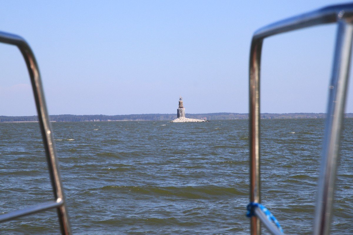
• Frombork. Stone underwater palisade between the western head of the Frombork port and the pier of the former passenger and yacht marina. They are marked by yellow buoys of the basin for turning white fleet vessels. A buoy closer to the shore means the edge of underwater obstacles.
• The surroundings of the Gdańsk and Elbląg ponds. There are stones in the water, it is shallow. It is not recommended to swim close to the pond.
• Kąty Rybackie. Wreck of a motor yacht at the shore between the "Barkas" marina and the Old Fisherman's Harbor.
• Nowa Pasłęka - outlet. Flooded eastern breakwater at the entrance to the Ujście Port in the Pasłęka Canal.
Havens
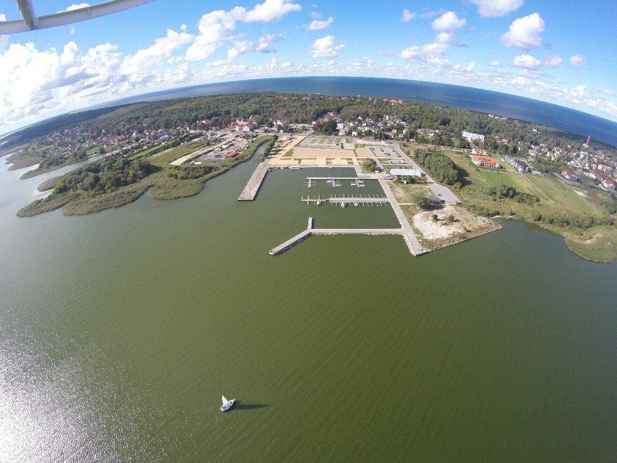
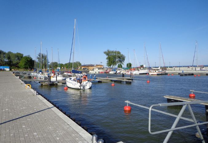 Krynica Morska - Krynica is for the Lagoon what Mikołajki or Giżycko are for Mazury. The biggest yacht port on the Lagoon. Clean, sea beaches, developed commercial, gastronomic and hotel facilities, lots of attractions. The eastern part of the port is a yacht and passenger marina divided by a Passenger pier, to which the passenger units of the white fleet are fired. The eastern swimming pool of the marina is a closed yacht wharf. On the east side of the Passenger pier there are three swimming pools divided by piers, some of which are intended for regular residents of the Krynica Morska Yacht Club and professional units. At Pier 1, there is a police boat, a boat cutter and units using a slip. At pier 2, residential yachts moor to characteristic orange buoys. The rest of the seats belong to hospitable yachts.
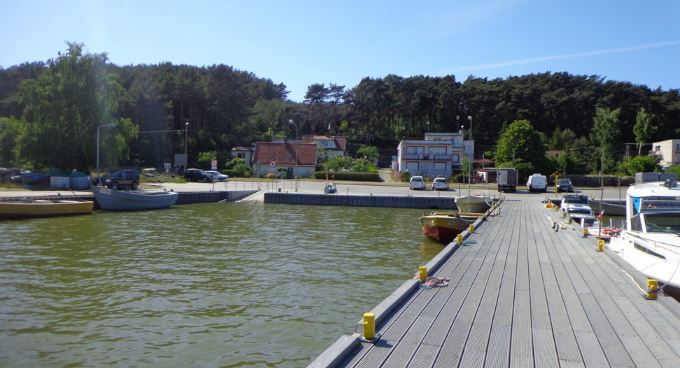 Piaski (Nowa Karczma) - an old fishing village of a summer nature is located about 4 km from the state border of Poland and Russia. The name Nowa Karczma comes from the inn built in the Middle Ages, thanks to the privilege from 1429 given to the innkeeper Hannos by the Teutonic commander Henryk Holt. Around 1600, the first church was built here. Until today, the Mennonite cemetery from the 18th century has survived. Over time, the settlement of Piaski developed, changing its location several times (it moved to the west). The reason for this was wandering sand dunes, moving sands systematically covering the village buildings. The last such migration took place in 1825. After the devastation of the war, the development of the village dates back to 1964, when the asphalt road from Krynica Morska was brought to Piaski. The population of the village is engaged in fishing and in the summer the service of tourist traffic. Letnisko has a clean, extensive seafront with unpolluted water and picturesque dune embankments covered with forest. Near Piasków, there is a dune with a height of 31 m above sea level. being an attraction of the area. Since 1990, Piaski has been part of the city of Krynica Morska.
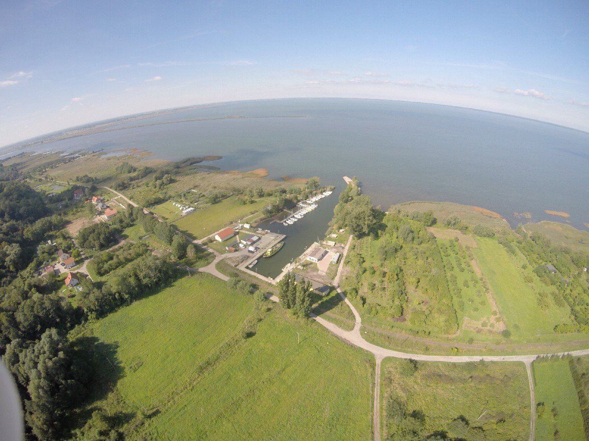
 Frombork is located on the Warmińska Plain at the northern end of the Elbląg Upland, it is the largest port city on the southern shore of the Lagoon. Sea border crossing for yachts sailing to Kaliningrad. The port consists of breakwaters (the west breakwater is longer), the port channel and the port basin, expanding towards the west. Viewed from the water side, the port resembles the letter P. Part of the breakwaters and the port channel has berths for mooring. The Port of Frombork as one of the last is waiting for revitalization. At the moment it is a typical fishing port but it has several places for tourists and it is worth visiting.
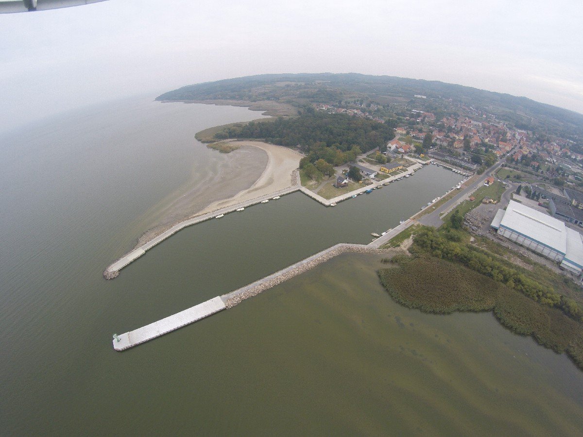
 Tolkmicko, the port consists of a long, rectangular pool, the initial part of which is about a hundred-meter long entrance channel with eastern and western breakwaters. The western fleet can moor white fleet ships from both sides. The entrance channel is 40 meters wide. Behind the entrance channel, the harbor basin extends to both sides and is 240 meters long and 58 meters wide.